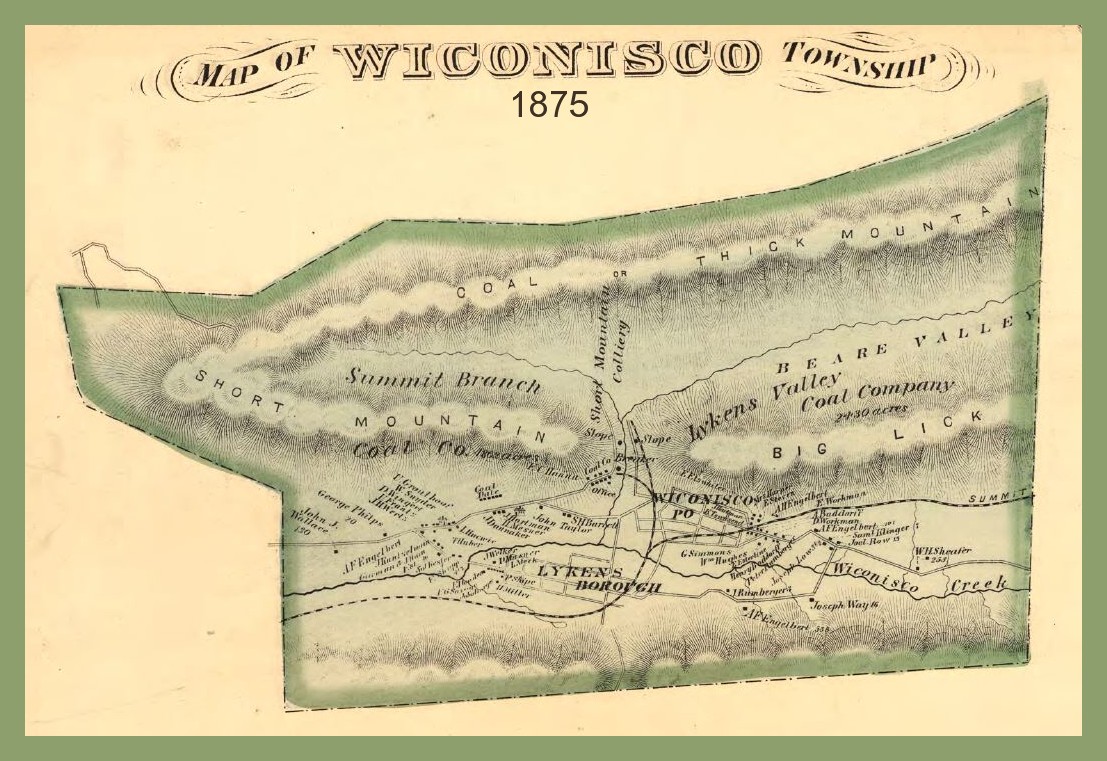
A map of Wiconisco Township, Dauphin County, Pennsylvania, from 1875, showing coal mining operations of the Lykens Valley Coal Company at Bear Gap – between Short Mountain, Coal or Thick Mountain, and Big Lick Mountain.
The two slopes noted on the map as “slope” are the Short Mountain Slope (west) and Lykens Valley Slope (east). The breaker noted on the map is one of four that was constructed in the gap by the coal company, each one larger than the prior one.The creek running through Bear Gap is the Bear Creek which flows into the Wiconisco Creek on the northern edge of the Borough of Lykens. The town of Wiconisco is situated at the foot of Big Lick Mountain, just to the east of Bear Gap. The rail line is shown extending into the gap, with an extension beginning at the Wiconisco Creek south of the town of Wiconisco and extending eastward toward Williamstown (on map as “Summit”, for Summit Branch Railroad).
Corrections and additional information should be added as comments to this post.