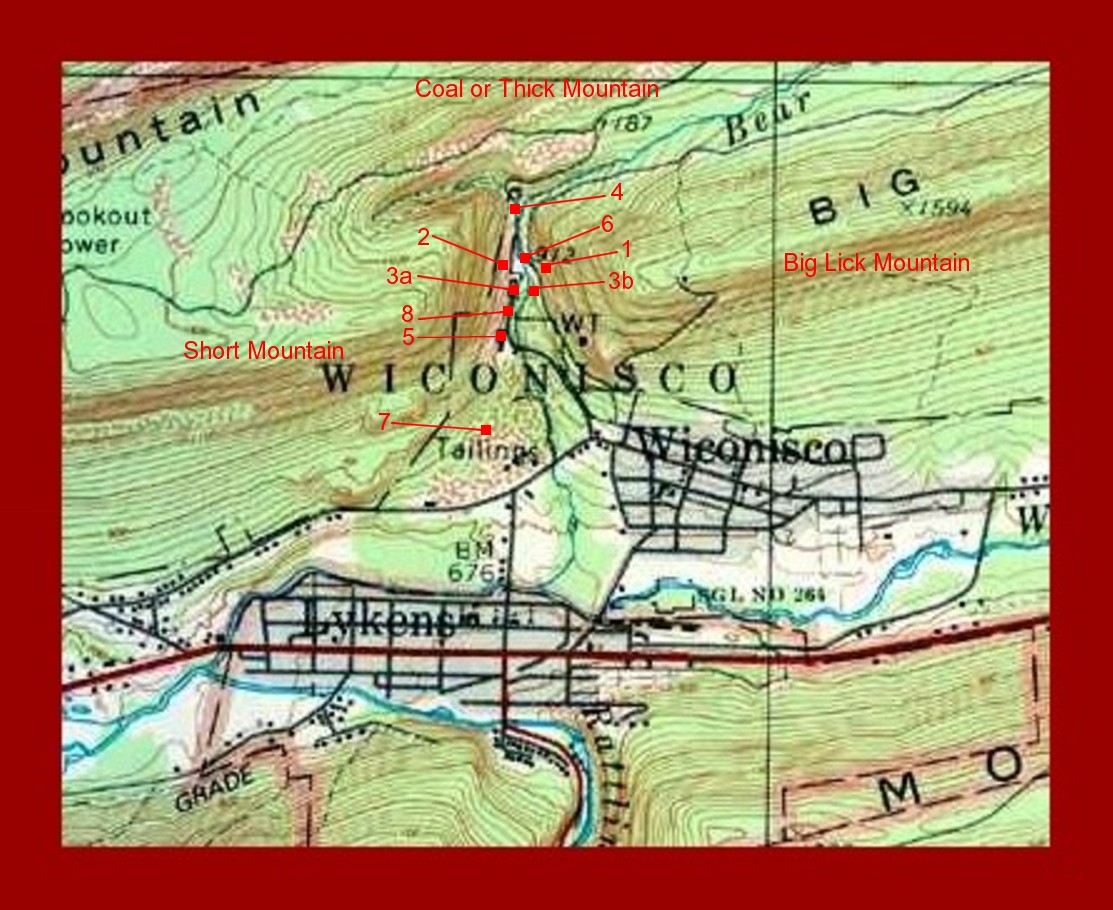
This topographical map shows the approximate location of the tunnels, slopes and major structures at the Short Mountain Colliery of the Lykens Valley Coal Company, Bear Gap, Dauphin County, Pennsylvania.
Bear Gap is located between Short Mountain on the west, Coal or Thick Mountain on the north, and Big Lick Mountain on the east. Bear Creek winds its way through Bear Gap and joins the Wiconisco Creek at the northern border of Lykens Borough. The town of Wiconisco is also shown as situate to Bear Gap.
The small red squares are identified by number.
#1 – Lykens Valley Tunnel Entrance. In operation from about 1836 to 1869.
#2 – Short Mountain Tunnel Entrance. In operation from about 1853-1869.
#3a – Short Mountain Double Slope Entrance. In operation from about 1870- 1915.
#3b – Lykens Valley Slope Entrance. In operation from about 1870-1915.
#4 – Bear Gap Tunnel Entrance. About 3300 feet inward to airhole.
#5 – Short Mountain Colliery Breaker. Completed and in service from 1913.
#6 – Short Mountain Colliery Shaft. Completed and in service from 1915.
#7 – Tailings or Culm (waste from anthracite coal mines, consisting of fine coal, coal dust, and dirt).
#8 – Lykens Electrical Power Plant.
Corrections and additional information should be added as comments to this post.

2 thoughts on “Lykens Valley Coal Company – Location of Operations in Bear Gap”
Comments are closed.