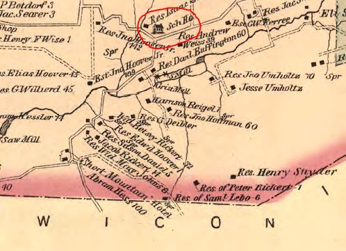
A portion of a Lykens Township map from 1875 shows the location of the Geise School. The road going south and west from the school is currently named Specktown Road. Beyond the lower left corner of the map, Specktown Road joins with the Crossroads (which goes south to Loyalton). Continuing north and east from the school, Specktown Road enters the Borough of Gratz – the green area in the upper right corner of the map. The road connecting with Specktown Road at the Geise School is Shade Road, which is an east-west connector to the Crossroads.
The mountain on the southern border of Lykens Township is Short Mountain, where coal mining operations were located until about 1932.
Historically, the community south of the school and immediately surrounding the school was known as Specktown. Thus, the Geise school primarily served pupils from that community.
_____________________
The map cut is from the Pennsylvania Archives.