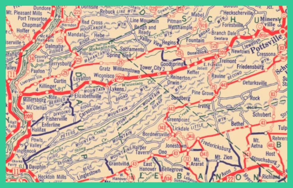
A Pennsylvania Highway Map from 1930 showing the location of improved highways in the Tremont and Pine Grove areas of Schuylkill County, Pennsylvania. The information presented below describes the improvements made in the 1930s to to the road system particularly effecting Tremont Township.
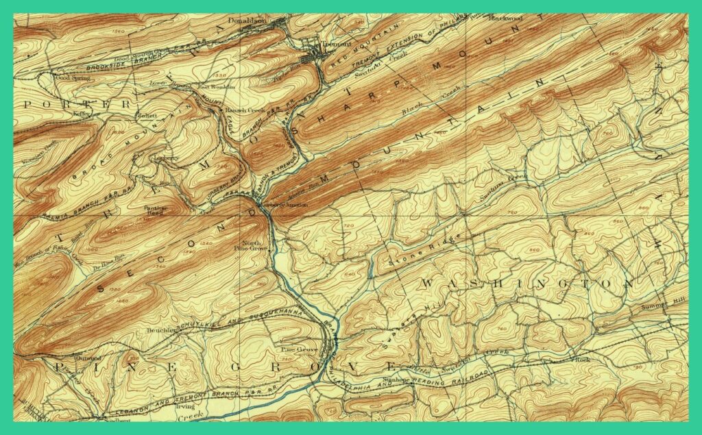
An 1892 section of a topographical map showing physical features of Tremont Township.
_______________________________________________________
The following article is part of a Joseph A. Zerbey compilation of writings worked on by the pupils of the Tremont Township High School, E. J. Webb, Supervising Principal; N. C. Smith, Principal.
From the Pottsville Republican, November 24-27, 1934:
It is our aim to unfold to our readers, the history of an interesting township; not for its history alone, but for its physical features, woodlands and forests, and its tremendous underground wealth…. Tremont Township, from its outward appearances, reveals only a small part of the wealth it really contains. The history revolves itself around its hidden treasure — coal. Examining a table of evaluations, we readily observe the enviable position it really holds, and it is readily classified as the “richest of townships” with an assessed value of $4,800,000. Thus for the purpose of clarification, we shall divide the history into a number of distinctive diversions…. [One of which is presented below, i. e. “Geography”].
Geography
In the southwest corner of Schuylkill County, there appears a rather elongated township, almost five times as long as its width, with the following as its boundaries: On the north it is touched by Porter Township and Frailey Township, on the east by Reilly Township, and on the south by Pine Grove and Washington Township, and on the west by Lebanon County. The township was originally formed from Pine Grove Township in 1847. The origin of its name can be traced to a French word, “Tre-mont,” which means three mountains; these three mountains being the Broad Mountain, the Stony Mountain and the Red Mountain. They are the remnants of the famous Appalachian Mountains at one time estimated to be higher than the Rocky Mountains. Thus they can be readily classified as old worn down mountains, which have lost their height, ruggedness, and jagged appearance, and now revealing themselves as rounded-off tops, with gently sloping sides. The evidence of a former greater height can be observed in the partially filled valleys with material that came from the top of the mountains. At the base of the mountains are found vast stretches of huge boulders, piled to the extent that vegetation finds great difficulty in piercing the piled-up rocky crust. By closer examination it is observed that the same type of rocks rested at the base as are found on the summit.
The valleys are extremely narrow. With the abundance of huge boulders that partially fill them, we find the land poorly adapted for farming, hence what farming is done, is done on a small scale, with small rewards to the tiller of the soil. Its advantages are turned elsewhere, as a land of narrow gaps, with the gentle sloping sides of Broad Mountain, it served as an excellent means for crossing the mountains, thus the appearances of a number of excellent highways.
As for highways, the new highway from Pine Grove to Tremont passes through a large portion of the township. This road was completed in 1932. A number of years previous to 1932 saw the completion of a concrete road from Pottsville passing through Tremont Borough, Tremont Township, and on to the Susquehanna rover. An even greater surprise came in the year of 1932; a connecting link between the two former highways was completed, meeting the one highway at the Lorberry Junction, and the other at Joliett. With such highways in the Township we find easy access to our Capital — Harrisburg, to our county seat — Pottsville, and to the rich agricultural regions of Pine Grove, the Clarks Valley, and the Hegins Valleys. Readily we can traverse its length of fifteen miles, and its width of three and one-half miles. The proposed new highway from Lebanon to Tower City will cross the entire width of the western part of the township.
The three mountains that figured in the origin of the Township’s name, however, are not the only mountains in the township. Sharp Mountain, sometimes called the Panther Head, having some resemblance to that animal’s head, its original name Sharp, indicates the shape of the mountain itself — as it comes to an abrupt point — traverses the southern part of the township. Another interesting mountain, nicknamed “Hickory,” due to the presence of the hickory trees on its round sloping sides, is located in front of another mountain called Second Mountain.
An observer, standing on the top of Lincoln Colliery, or the Joliett fire-tower, is greeted by a mountainous view and scenery long to be remembered. Facing in a southern direction we see the Second Mountain; to the right, the Sharp Mountain, to the left, the Red Mountain. In front of the Second Mountain, we see the small round-top hills composing the Hickory Mountains. The west is a glimpse of the mountains and valleys that form Jeff’s Swamp which would make history in itself. It is nestled at the accumulating point of several valleys that run together at this point, thus acting as a drainage marsh of the surrounding valleys.
Let us turn to Jeff’s Swamp for a moment. We find it an isolated and secluded spot, unsuitable for habitation because of its swampy surface, which at times resembles a mire. Even more interesting is the number of trails that pass through it, among them several fire trails and old log-wagon roads. A number of mine breaches dot the surface around the swamp. At a number of places along the old log wagon roads are found a series of logs, one lying against the other on the road, to present the wagons from sinking into the mud. Today, many of these logs are still lying there barely peeping above the surface encased in a grove of mud. This is another evidence of its swampiness.
As to the origin of the swamp’s name, Jeff’s, the following story is given. A settler by the name of Jeff Umbenauer cleared a field and established his residence there. Today, one can walk to the field and view its extent, surrounded by stone walls, from stones that came from the fields during the clearing. The foundation rocks of his home are still to be seen. This fact, along with many mining operations, now abandoned, and the plant life common to marshes, make it a most interesting place to travel through on foot. But woe to the traveler who is not careful. As he stands facing several valleys, as the open ends faced him, and the numerous trails that traverse the swamp, he is confronted by a problem that had sent many astray of trail, only to retrace themselves a day or so later.
_____________________________________________________
Corrections and additional information should be added as comments to this post.

