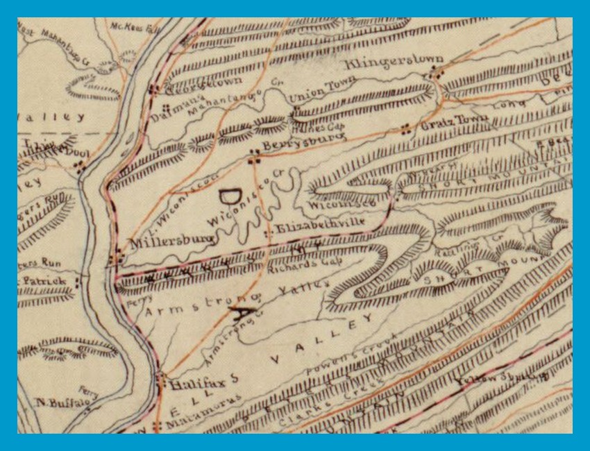
A portion of a map made during the Civil War by Confederate Mapmaker Jedediah Hotchkiss. The map was drawn from notes Hotchkiss made while serving as a teacher in the Lykens Valley during the school term of 1846-1847.
Places shown on the map include the river communities of Georgetown/Dalmatia, Millersburg, Halifax, and Liverpool; valley communities of Elizabethville, Berrysburg, Gratz Town, Wiconisco, and Klingerstown; Armstrong Valley and Powell’s Valley. The Lykens Valley Railroad and the Northern Central railroad are also noted on the map. Interestingly, the community of Lykens is not noted.
The Susquehanna River maps drawn by Hotchkiss were important to the Confederate Army as it moved up the Shenandoah Valley toward its objective of Harrisburg in 1863.
____________________________________
Map from the Library of Congress. This map was previously published on a post on the Civil War Blog, July 13, 2013, and on the Lykens Valley Blog, August 28, 2021.
Corrections and additional information should be added as comments to this post.