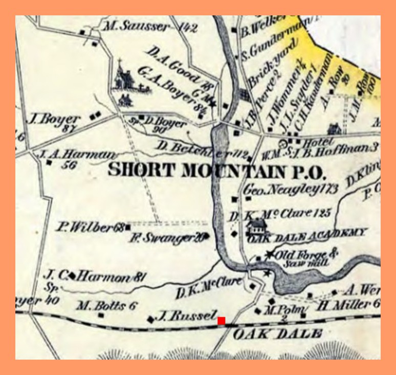
The 1875 map cut is from the Pennsylvania Archives. The red square shows the location of the Loyalton railroad station, referred to on the map as Oak Dale. Persons owning property and the acreage are also noted on the map.
Corrections and additional information should be added as comments to this post.