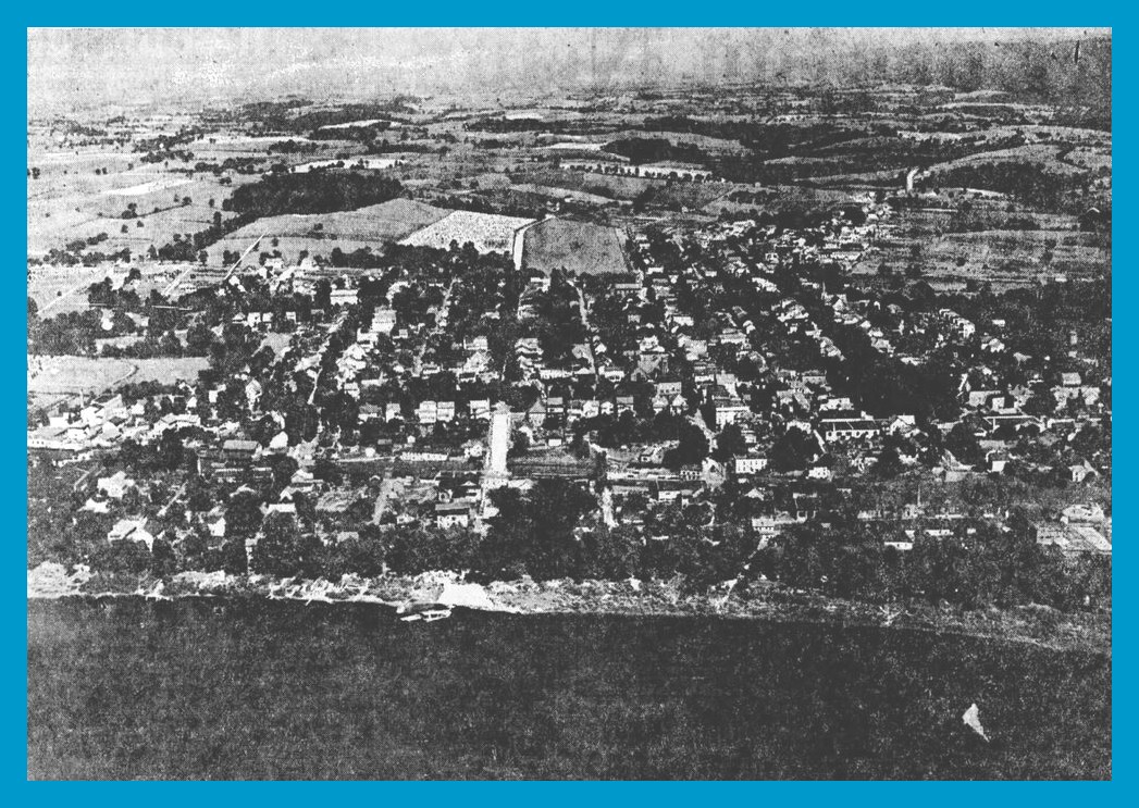
This aerial view of Millersburg, Dauphin County, Pennsylvania, appeared in a 12 May 1926 article on Millersburg in the Harrisburg Evening News. The photo was taken by Fairchild Aerial Survey Inc. as is noted in the lower left corner. Presumably, it was taken around 1926. Since the copy available for this blog post is a poor digital version of the Evening News from Newspapers.com, a clearer version must be available somewhere – and perhaps can be reproduced to replace this picture.
It appears that the picture was taken from the west looking east. The Susquehanna River is in the foreground and just to the left of center in the river is a docked ferry boat.
The article accompanying the photograph told some of the history of the borough, noted some of the industrial activities, and described the government and some of the fraternal organizations. It concluded with the following information about the transportation facilities:
Millersburg has made transportation history. As a gateway to the rich Lykens Valley coal region it became the western terminus of the Lykens Valley Railroad, completed in 1834, and the fourth railroad in the United States to transport anthracite coal. Millersburg was also the northern terminus of the canal connecting the Lykens Valley Railroad with the Pennsylvania Canal at Clark’s Ferry. Canal Boats, laden with coal or other freight, were taken to the Millersburg Canal to the dam at Clark’s Ferry, where this canal joined the Pennsylvania Canal connecting south with Harrisburg, Columbia and the Chesapeake Bay.
The old canal basin or loading station at Millersburg had a capacity of more than 100 barges and there in the boat building yards were constructed many of the boats which for years operated up and down the Millersburg and Pennsylvania Canals. The Millersburg Canal was so badly damaged by floods in 1889 that it was abandoned.
Millersburg is still the junction of the Northern Central division and Lykens Valley branch of the Pennsylvania Railroad system and is connected with the Susquehanna Trail – main motor highway north and south through the state – by a steam ferry across the Susquehanna.
Forming a strategic position in the highway system of the state, Millersburg is the center of roads entering from the main points of the compass. From the south, State Highway Route No. 1 connects the town with Harrisburg and the many highway routes centering there. It is the western terminus of the state highway through the Lykens and Williams Valleys and into Schuylkill and other counties to the east and northeast.
Several roads lead from Millersburg through the Uniontown Gap to Trevorton, Shamokin and points to the northeast. Eventually the direct route from Millersburg to Sunbury will be improved. Highway routes leading to the west are reached by the Millersburg Ferry or the Clark’s Ferry and Sunbury bridges.
Its position as a highway center, its two modern hotels, its many scenic attractions and its ability to provide for the needs of the traveling public make the town the natural mecca for motor tourists.
Corrections and additional information should be added as comments to this post.
______________________________
The Harrisburg Evening News contracted exclusively with Fairchild to produce aerial photographs of towns in their news coverage area. The Millersburg photo was No. 10 in a series. The only communities photographed in the the Lykens Valley area were: Elizabethville, Millersburg, Lykens, Williamstown, Wiconisco, and Halifax.