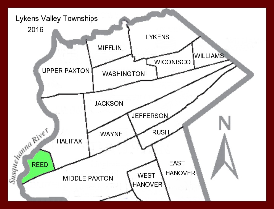
Reed Township, Dauphin County, Pennsylvania, was created in 1849 from parts of MIddle Paxton Township; from islands at the mouth of the Juniata River including Duncan’s Island and Haldeman’s Island; and from parts of Halifax Township including the Susquehanna River portion of Peter’s Mountain. Prior to its establishment as a township it was known as Penn Election District.
The following explanation is from William Henry Egle‘s History of the Counties of Dauphin and Lebanon of the Commonwealth of Pennsylvania, published in Philadelphia in 1883 by Everts and Peck:
Reed Township was erected by the act of Assembly of 6 April 1849 which directed:
“That portion of the qualified voters of Penn Election District, Dauphin County, that reside in Middle Paxton Township, shall hereafter vote at the regular place of holding elections for said township, and the balance of the voters of said Penn Election District shall hold their election at the new schoolhouse on Duncan’s Island, and shall be erected into a separate township and school district to be called Reed Township,” etc.
The township is bounded on the north and northeast by Halifax Township, on the west by the Juniata and Susquehanna Rivers, and on the south and southeast by Middle Paxton Township. It includes the large islands on the western side of the river – Duncan’s and Haldeman’s. It is named for William Reed, who resided about halfway between Clark’s Ferry and Halifax. Previous to being set off as Reed Township, it was Penn Election District, formed off portions of Middle Paxtang [Paxton] and Halifax [Townships]. When the township was erected, the portion of Middle Paxtang Township reverted to the original township.
The history of this township centres chiefly around the islands at the mouth of the Juniata [River] , well-known by the general designation of Duncan’s Island. The southern part of the township includes the Susquehanna [River] portion of Peter’s Mountain, and the land is much broken. There are several fine farms on Powell’s Creek, while the lands on the large islands in the river are unsurpassed for cultivation. The Wiconisco Canal, connecting with the Pennsylvania Canal at Clark’s Ferry, and the Northern Central Railroad edge the rive the entire length of the township. Clark’s Ferry, at the crossing to the islands and the Juniata [River], named by the Indians Queenasnawakee, was for many years a noted place. Being hemmed in by the mountain and river, it has never increased beyond the usual country tavern.